Final Episode

October 2009
I received my official recognition from the AT Conference - here's the patch and special rocker panel.


I've included a painting by Frederic Edwin Church of the Rapids of the Susquehanna, which I think must be the place where the river cuts through the Kittatinny Ridge above Harrisburg, 1860 or so, long before the AT was envisioned.

As the days shorten and the leaves fall, I'm feeling nostalgic for all the years of seeing the Trail - the way its variety emerged gradually over the many excursions I made, and for the friends, family, and doggies who helped make it all so much fun. As it turned out, the end of the trail was to be the end of a marriage. So nostalgia is mixed with sadness for the loss, and for my naivete in not sensing how much was wrong even as I treasured the time in nature and the sense of accomplishment each day brought.

Maine to Georgia - Complete


May 3, 2009

Done! We hiked the final link in my complete section hike, ending at Devil Fork Gap on the state line between Tennessee and North Carolina.

It was a rainy day, but we felt lucky to hike for the first couple of hours in only fog. Then, when we were well committed to the route, light rain set in, perfect for umbrellas. The last section was 8.5 miles, including the usual southern Appalachian ups and downs, and ending in a cow pasture, one of my favorite features of the Trail.

If you've been following the adventure, you may remember that I climbed both Springer and Katahdin in the fog, so am quite used to not seeing the long view. Again today, we focused on the near at hand, old orchards with apple trees in bloom, trilliums everywhere, a small waterfall near the end of the day.

It's been a wonderful 12 years, and thank you to all the loyal supporters who have read and commented along the way.
Thanks to those who have driven (Augusta especially), dried me out during hurricanes (Michael and Susan) and those who have accompanied:

Phoebe for parts of the Shenandoah, New Hampshire, Pennsylvania, this final section, and for believing.
Ginny and Martha for three very long sections in New Hampshire and Vermont.
Abby for Glastonbury Mountain, Vermont.
Louisa and Li Zhuang for some of the bogs of Maine.
Mabel for some Pennsylvania miles.
Oscar and Chloe for canine companionship.

Bald and Not So


May 2, 2009

For several days, my most faithful AT supporters and companions have been sharing the experience. Phoebe joined me in Johnson City, and with a second car we've been able to car-spot and make double progress!
At the top of Beauty Spot Bald (above) Phoebe and I enjoyed views of the Unaka and Bald Mountain ranges on a gorgeous day. Several through hikers were lingering up there, so we asked one to be our photographer.

Some mountaintops are not so picturesque - here's Unaka, flat on top, a forest of red spruce (reminding us of New England) but not much to indicate the actual top.
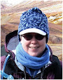
In case we'd been overcome by amnesia, here's a marker to let us know we're on the AT. Miraculously, a through-hiker came by just in time to snap a photo.

Today, we hiked in fog and rain from Big Bald (where we could see that it was a bald but not much more) to Sam's Gap, where I-26 has cut a drastic gash through the landscape. Here we are crossing an old farmstead meadow near Street Gap.

We've rented a house at the Wolf Laurel resort development, so we are living in luxury for these last few days of the hike. Stay tuned for the finale!

Civil War History


April 24, 2009

Six miles in from the nearest paved road, on the ridge of the Bald Mountains, I come across the Shelton graves. Two brothers from East Tennessee who had chosen to serve in the Union army, were killed here by Confederates on their way back from a visit home. I learned that people of this area didn't want to secede, but were occupied by force and made to join the southern side of the Civil War. Someone is still tending these gravestones, cutting the grass and leaving silk flower arrangements.

So much history in these overgrown woods!

Bald Mountain Trek


April 21, 2009

I'm working on a 20-mile stretch of the Bald Mountains where the Trail, and the state line between Tennessee and North Carolina, make a big northward bend. Camp Creek Bald has a bunch of telecom towers on top, and a road for trucks to service them, so I used it to get up into the middle of the section.  

Above is Blackstack Cliff, a forbidding-looking pile which made me feel a little nervous about venturing into the wilderness!

But it turned out as usual, there were plenty of through hikers. Much of the trail was well-constructed; here's a flight of stone steps, thanks to the trail crews! 


Up here at 4200 feet, trout lilies were having their fling along trailside.

And on Cold Spring Mountain, one of the nice southern Appalachian meadows. Several old roads come up here, and the gaps are named for the farmsteads that were here: Fox Cabin and Jerry Cabin.


Here's the view back south to Camp Creek Bald where I started this morning.


Trail Town - Hot Springs


April 17, 2009

Hot Springs is a famous AT landmark - the Trail is the sidewalk here along Bridge Street. Trains cross the street several times a day, passing right next to the campground where I'm staying - midnight and 5 am every night. I know because of the train whistle! It brings back memories of the "old days" by which I mean growing up in the 50s when trains were everywhere.After crossing the French Broad River, the Trail leaves the sidewalk again and climbs up Lovers Leap Ridge. Here's a view back to town. This hike is another excellent bike-hike, 8 miles down down down to the river and then the walk back up to Rich Mountain Fire Tower.

Approaching Hot Springs

April 16, 2009

Coming into Hot Springs I was able to do a great bike-hike. Here's an overlook along NC Route 209 looking back south toward the Max Patch area. The road hugs the cliff top, then plunges down to the French Broad River.

Here's the hike back up to where I started - there's one of the many hikers I met along the way.
In Hot Springs, I'm camping where a CCC camp was located, and here's part of the treadway that they built in the 1930s.

Dicentra canadensis


April 13, 2009

While strolling along on Sunday, I spotted a patch of spring flowers, and snapped a photo.

On close examination, it's squirrel corn, a relative of dutchman's breeches and bleeding heart - so nice!

Sun and Rain


April 13, 2009

Sunday (Easter for some) was a perfect sunny day, so I "skipped ahead" a few miles to famous Max Patch, one of the classic Appalachian balds. A snow drift still clung just below the crest where the wind must have compacted it all winter. Two days later I went by the trail head and the snow was gone. Quite a few picnickers were up there with dogs and frisbies although it's quite a remote place, about a 10 mile drive up a dirt forest road.

Most days have been cloudy or foggy - today I hiked Walnut Mountain and Bluff Mountain. Here's Walnut Mountain Shelter, built in 1938, I'm guessing out of chestnut logs.


Here's the top of Bluff Mountain, at 4600 feet, in the clouds. I was glad to be on a day hike, returning to the lowlands for the night - I met numerous hardy through-hikers who were camping in the fog and drizzle.

Smoky Mountain Springtime


April 11, 2009


I'm at it again. After a drive from New England on which I encountered snow flurries on the Hudson and daffodils through Virginia, I'm headquartered in Newport, TN. 

I'll be hiking the Tennessee-North Carolina state line northward.

On my first day, I finished the last stretch of the Smokies and crossed the Pigeon River. Here's the Trail along State Line Branch, plunging down to the Pigeon River (and I-40).

 Now I'm starting up the Bald Mountains - the first hike to the top of Snowbird Mountain was socked in with low-hanging cloud cover. 


These funky trilliums (if I remember right, they're called "toad shade") are blooming in damp places.


Further up the slope, trailing arbutus are blooming along the trailside. 

You can see how foggy it is here.

Architectural Fantasyland


April 4, 2009

I've been meditating on nature and artifice. I went on another art experience ... a tour of Philip Johnson's landscape in New Canaan.

A forest was turned to farmland for a century or two, then overgrown. Then for 60 years after 1945, PJ re-cleared fields, restored and enhanced stone walls, built a pond in the valley, and constructed a series of pavilions. Each one is sculpture in the landscape but simultaneously a building that can be experienced from within, and also a container for art.

Like an Olmsted park, there is an illusion of nature, but it's carefully manipulated. PJ's humor is everywhere, from the Poussin painting in the Glass House hinting at nature as artist's canvas, to the cast-in-bronze driftwood sculpture, the mini-pavilion in the pond, and the sampling of all the design fashions of the 20th century. And yet ... what a skillful abstract composition of line, cube, cone, positive and negative, transparent and opaque.

Art from a Book

April 1, 2009

Julie Cockburn's "The Beetle Book" on display at the Yale British Art Center to celebrate the Sustainability Summit (that's what they SAY, but it could be an April Fool joke). The beetles are illustrations which she cut out of the book and turned into 3-D paper art - I love it!

I'm getting psyched for my own performance piece - I'll be off soon to Tennessee for another outing on the Trail - I'll be filling in the last gap to complete my walk. Stay tuned ...

West Coast Week

March 4, 2009

Bob & I took a low-key vacation to California where it was already spring (!) at the "Hotel Bressack."

Our splurge was a weekend with Abby & Dennis to Pacific Grove and Monterey - the jellyfish are only one of many marvels at the aquarium.

Phoebe and I indulged in local tourism with a visit to some art on the Stanford campus,


and I enjoyed the Los Altos redwood grove in high water, a first for me.

Winter Activities

January 31, 2009

It's been a snowy winter, a nice change from the usual freezing rain and slush in my opinion - Oscar and I try to get out every day for a walk or snowshoe. Here we are at the north end of West Rock looking out over Hamden and the New Haven skyline.

Otherwise, I'm studying to be a volunteer tax preparer for people with low incomes and simple taxes. And trying to stay in shape for next spring, which is difficult during the hibernation season.