November 13, 2007
As a side trip I re-visited the Pochuck Creek crossing, an area where suburban development has left only the swamp land free for the Trail.
Back in 2001 when I was hiking this area, I looked out from the heights trail north, and spied this tall suspension bridge in the distance. But alas, there was no path to get to it - so the AT then was a road walk detour.
In 2002 the connecting boardwalks were finished by the hard-working trail builders, so now we can stroll over a mile of walkways through the marshes, crossing the bridge in the middle.
You can see this route clearly on Google Earth as well.
View Larger Map
It seems a popular route for local aerobic walkers, bird- and butterfly-watchers.
This is probably the last new addition to my AT miles for 2007 - I'm up to 1557 miles total - can't wait for spring 2008!
New Jersey's Pochuck Quagmire
Crossing the Great Valley (again)

This was a short hike, under 3 miles. At one end the Interstate with its diesel-belching trucks. Within 5 minutes, the Trail crossed railroad tracks and passed by this brick manufacturing facility with its own rail siding to load the pallets for transport. At the far end of the trip is the 1894 Lindamood School, part of the Settlers Museum. Traveling back through time ...
Big Walker Mountain
November 11, 2007
Getting an early start, deer in the pasture with the frost melting under the sun's rays.
Big Walker Mountain is the imposing wall blocking our way in the distance.
We cross several open pastures on the approach - here's my hiking buddy, "Tripod Trek-er" setting up for a shot.
Bridge Out
November 10, 2007
As I was working on one of my bike-hikes, I met another section hiker with his camera gear, and offered him a ride back to his car. We teamed up and car-pooled for a couple more days and were both pleased with the extra miles we were able to cover.
Here at Laurel Creek, a bridge has been removed leaving only the sturdy piers, and the Trail is rerouted over a road bridge. Will this AT bridge ever be replaced?
Burke's Garden
November 8-10, 2007
Burke's Garden, nicknamed "God's Thumbprint" caught my attention because of its dramatic appearance on the topo map - a high oval valley surrounded on all sides by a high ridge. The AT travels the ridge along one side of the Garden - the best view is from Chestnut Knob, but it's glimpsed for several miles through the trees during the ridge walk. With the leaves off, I had good views on several days' hikes.
Virginia Ridge & Valley

November 8, 2007
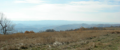
Unable to settle into home life, I'm off to southwestern Virginia for one last fling before winter. Here is Chestnut Knob - after climbing through oak forests for a thousand feet, you emerge into this high meadow where old pastures are kept mown and open. Behind are expansive views of ridge and valley including Big Walker Mountain, a former route of the AT, and Mt. Rogers looming over it way off to the south.


